Eddie Sheerr

Wildfire smoke from NWT fires prompts Air Quality Alert from Environment Canada

Smoke from distant forest fires may cause a reduction in air quality.

Current details: Smoke is causing or expected to cause poor air quality and reduced visibility.

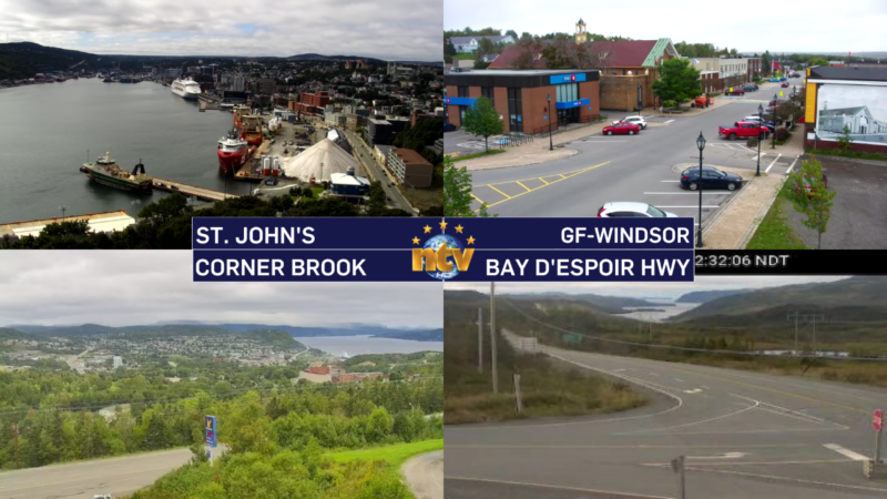
Locations: most of Newfoundland and Labrador

Time span: through Thursday or longer.

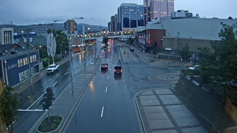
Remarks for Newfoundland: Smoke plumes from distant forest fires can be expected over Newfoundland at various times over the next couple of days or more. The smoke will be more persistent in some areas than others, especially central, western and northern Newfoundland as suggested by latest dispersion models. Some of the smoke will remain aloft while some will descend closer to ground level causing reduced air quality at times. Associated haze will likely give the sun a reddish appearance.

Remarks for Labrador: Smoke plumes from distant forest fires can be expected over Labrador at various times over the next couple of days or more. The smoke will be more persistent in some areas than others as suggested by latest dispersion models. Some of the smoke will remain aloft while some will descend closer to ground level causing reduced air quality at times. Associated haze will likely give the sun a reddish appearance.

Wildfire smoke can be harmful to everyone’s health even at low concentrations. Everyone can take action to reduce their exposure to wildfire smoke.

People with lung disease (such as asthma) or heart disease, older adults, children, pregnant people, and people who work outdoors are at higher risk of experiencing health effects caused by wildfire smoke. Speak with your health care provider about developing a management plan for wildfire smoke events and maintaining a supply of necessary medications at home and always carrying these medications with you during wildfire season.

Stop or reduce your activity level if breathing becomes uncomfortable or you or someone in your care feel unwell. Contact your healthcare provider or local health authority if you develop severe symptoms or need advice.

Check the Air Quality Health Index (AQHI) and monitor your symptoms. People respond differently to smoke. Mild irritation and discomfort are common and usually disappear when the smoke clears. Drinking lots of water can help your body cope with the smoke.

If you have an HVAC system in your home, use the highest-rated MERV filter for your system (ideally rated 13 or higher) and set the fan to recirculate air constantly. You can also use a portable High Efficiency Particulate Air (HEPA) air cleaner. Keep your doors and windows closed if the temperature in your home is comfortable.

Take a break from the smoke at a location in your community where you can find clean, cool air.

If you must spend time outdoors, a well-fitted respirator-type mask (such as a NIOSH-certified N95 or equivalent respirator) that does not allow air to pass through small openings between the mask and face, can help reduce your exposure to the fine particles in smoke. These fine particles generally pose the greatest risk to health. However, respirators do not reduce exposure to the gases in wildfire smoke. It is important to listen to your body and reduce or stop activities if you are experiencing symptoms.

Be sure to check on people in your care and those around you who may be more susceptible to smoke.

Reduce sources of indoor air pollution. If you can, avoid smoking or vaping indoors, burning incense and candles, frying foods, using wood stoves, and vacuuming. Dust on indoor surfaces can be removed by wiping and wet mopping during a pollution episode.

If you experience any feelings of stress, anxiety, or depression, contact your mental health care provider for advice or visit https://www.wellnesstogether.ca/en-CA.

Visit http://www.airhealth.ca for information on how to reduce your health risk and your personal contribution to pollution levels, as well as for current and forecast AQHI values.

A Frost Advisory is in effect Tuesday night for much of central, western, and southern Newfoundland

THIS WEATHER ALERT HAS BEEN ENDED

A Frost Advisory has been issued for Tuesday night into early Wednesday morning by the Environment and Climate Change Canada Weather Office in Gander. The Frost Advisory is in effect for the following areas:

  • Burin Peninsula
  • Connaigre
  • Burgeo – Ramea
  • Channel-Port aux Basques and vicinity
  • Corner Brook & vicinity
  • Deer Lake – Humber Valley
  • Gros Morne
  • Bay St. George
  • Buchans and the interior
  • Green Bay – White Bay
  • Parson’s Pond – Hawke’s Bay

Current details: Frost may damage some crops in frost-prone areas.

Minimum temperatures: -2 to +2 in low-lying areas.

Locations: western, central and southern Newfoundland

Time span: tonight into early Wednesday morning

Remarks: Patchy frost is expected to form as clear skies and light winds coincide with cool temperatures, especially in low-lying areas.

Cover up plants, especially those in frost-prone areas.

Frost advisories are issued when temperatures are expected to reach the freezing mark during the growing season, leading to potential damage and destruction to plants and crops.

Tuesday starts chilly, but this afternoon should be lovely!

Good Tuesday morning!

We are off to a chilly start for much of the Island with temperatures in the lower half of the single digits for many areas. I suspect there is definitely some patchy frost, even though Badger was the only ‘official’ weather station to dip below freezing, and as of 5:30 AM NDT is reporting a temperature of -1º.

Morning lows the day of September 26, 2023
Today’s low temperatures | September 26, 2023

A good bit of Labrador is also waking up some chilly temps this morning, with areas in the west also holding between 0º and 5º to begin the day.

This is a map of today's morning low temperatures across Labrador, for September 26, 2023.

The rest of today will generally be quiet and sunny across most of the Province as a ridge of high pressure builds in. Some clouds will push into central, northeastern, and eastern Newfoundland coastal areas during the afternoon and evening, including the St. John’s area. And since the winds are northerly, there *could be* some drizzle in there. I’ll be watching the satellite and radar all day and will have updates as needed. It also looks like the southern coast of Labrador, north of the Straits, from Mary’s Harbour to Cartwright, will also see the clouds stubbornly hanging around today.

The forecast for Tuesday, September 26, 2023. Expect sunshine over much of NL with some clouds moving in later east and central
Today’s forecast | September 26, 2023

Tonight will again be on the chilly side as clear skies and light winds are expected across much of the Island. A Frost Advisory will again be in effect, but this time it’s for southern central and western parts of the Island and lows will be in the -2º to +2º range in low-lying areas.

Frost Advisory for the night of September 26-27, 2023

A quiet week ahead as a large high-pressure centre settles across the region

Tonight’s weather across Newfoundland will be mostly clear with lows ranging from 2 to 6 degrees Celsius. Some areas might experience slightly cooler temperatures with a chance of patchy frost. A Frost Advisory is in effect for much of the Island for tonight.

Frost Advisory for the night of September 25-26, 2023.

Tomorrow, expect sunny skies and mild temperatures in the middle teens, perfect for outdoor activities. However, the eastern and central parts of the island will see some high clouds increasing in the afternoon.

Labrador is in for a cooler night, with temperatures dropping to lows of 3 to 7 degrees Celsius. The western parts of the region will likely see the chilliest conditions. As we head into Tuesday, the Big Land’s weather brings a mix of temperatures, with highs ranging from 8 to 16 degrees Celsius. Coastal areas will be on the cooler side.

The rest of this week looks fairly tranquil as an area of high-pressure sets up shop. Expect highs in the teens and lows in the single digits across the board. Sunshine will be plentiful and overnight will be clear and crisp, with some pockets of fog.

We can thank this tranquil weather to a ridge in the jet stream that is going to be stuck west of the region for the next few days.

Monday starts soggy for some, but it’ll turn around this afternoon!

FROST ADVISORY IN EFFECT FOR TONIGHT

A weak area of low pressure moved over the Island Sunday night and brought yet another round of light rain, after what was an otherwise beautiful Sunday for many. That low will depart today, albeit a bit slower than I’d like to see. This will do a couple of things, it will keep the showers on the go for areas of eastern and northeastern Newfoundland this morning and it will also bring a fairly cloudy morning to the Island. At the same time, much of Labrador will wake up to sunny skies or a mix of sun and cloud.

Throughout the day, the the clouds will eventually clear off for most of the Province, as an area of high pressure builds in from Quebec. This process will yield more and more sunshine as the day wears on. The animation below times out the departure of the clouds.

Temerature-wise today, we are looking fairly seasonble, with highs reaching the upper single digits to lower teens afternoon across the region. Wind speeds will generally decrease as the day wears on and evening approaches.

Saturday starts nice, but rain and showers arrive later today and this evening

Saturday’s Outlook

The day will start off sunny for much of the Island, but showers will pop over the West Coast early in the day, and then over central and eastern areas in the afternoon. Highs will be warmer, into the middle and upper teens. It will also be a bit breezy, with westerlies as high as 60 km/h.

Rain will move into eastern and southeastern areas Saturday evening and will linger into very early Sunday morning.

Futuirecast times out the showers quite well, as you can see in the video below.

Labrador will have a few showers here and there throughout the day, with highs of 8 to 14.


Sunday’s Outlook

A few showers over central and western Newfoundland, and in Labrfaodr West. Otherwise it is partly to mostly cloudy with highs in the upper single digits in Labrador to middle teens on the Island.

The Long Range

Quiet weather takes hold for next week as an area of high pressure builds in. Highs will be in the teens and lows in the single digits, pretty well across the board.

After a chilly Friday night, Saturday will see a nice turnaround… for some!

Tonight’s Outlook

The weather across the Island looks fairly calm overnight, except on the GNP where showers will be on the go. Otherwise, we can expect lows of 6 to 10 for most. That being said, some areas will get colder, especially eastern and central, and FROST ADVISORY is in effect for tonight for those areas. Skies are partly cloudy to mostly clear.

Labrador will see showers on the coast, while inland areas are partly cloudy. Lows of 3 to 8, which will be warmer than last night for most!

Saturday’s Outlook

The day will start off sunny for much of the Island, but showers will pop over the West Coast early in the day, and then over central and eastern areas in the afternoon. Highs will be warmer, into the middle and upper teens. It will also be a bit breezy, with westerlies as high as 60 km/h.

Rain will move into eastern and southeastern areas Saturday evening and will linger into very early Sunday morning.

Labrador will have a few showers here and there throughout the day, with of 8 to 14.


Sunday’s Outlook

A few showers over central and western Newfoundland, and in Labrfaodr West. Othewise it is partly to mostly cloudy with highs in the upper single digits in Labrador to middle teens on the Island.

The Long Range

Quiet weather takes hold for next week as an area of high pressure builds in. Highs will be in the teens and lows in the single digits, pretty well across the board.

Environment Canada issues Frost Advisory for Friday night for Eastern, Central Newfoundland

THIS ALERT HAS BEEN ENDED AS OF SEPTEMBER 23, 2023

The ECCC NL Weather Office in Gander has issued a Weather Alert. A Frost Advisory is in effect from late Friday night to early Saturday morning. The areas under the advisory are as follows:

  • The Avalon Peninsula North
  • The Avalon Peninsula Southeast
  • St. John’s & vicinity
  • The Avalon Peninsula Southwest
  • Grand Falls-Windsor and vicinity
  • Bay of Exploits
  • Bonavista North
  • Clarenville and vicinity
  • Gander and vicinity
  • Green Bay – White Bay
  • Terra Nova

Current details: Frost may damage some crops in frost-prone areas.

Minimum temperatures: +2 to +9 in northeastern Newfoundland, -1 to +5 elsewhere (coolest in low-lying areas).

Locations: Avalon peninsula, eastern and northeastern Newfoundland

Time span: early Saturday morning.

Remarks: Patchy frost is expected to form as clear skies and light winds coincide with cool temperatures, especially in low-lying areas.

Cover up plants, especially those in frost-prone areas.

Frost advisories are issued when temperatures are expected to reach the freezing mark during the growing season, leading to potential damage and destruction to plants and crops.

Friday will be the coolest day in the St. John’s area since late June!

A trough axis is moving through overnight and this will do two things. It will drive rain and showers across the Island overnight into early Friday and push the coolest air of the season as far east as the Avalon as we close out the work week. While the rain we see tonight will not be overly heavy, it will be a little bit of a nuisance. Future radar paints this picture very well. Notice by 7 or 8 AM Friday morning it’s done with.

Highs across the Island tomorrow will struggle to get out of the upper single digits to lower teens. While today was the coolest day since June for many areas of central and western Newfoundland, tomorrow will be the coolest day since that time frame in the east.

Any showers we see in the east will be done with early Friday, while the remainder of the Province will see a very nice day. There will be some showers in Labrador West by the afternoon. Speaking of Labrador West, it will be a cold one tonight. Expect a low near -1 and patchy frost!

Beyond Friday we are in for a decent start to the weekend on the Island, with highs rebounding nicely in the upper teens for Saturday. However, Sunday will be a tad cooler and rain will be widespread in eastern Newfoundland. Labrador West will also see some rain on Saturday.

Eddie’s mid-day update; rain becomes widespread across the Island this afternoon and evening

A trough axis is going to pivot across the Island this afternoon and night and the result is going to be rain becoming more widespread as the day and evening progress. The rain will eventually move off the eastern side of the Island later tonight and early Friday. Future radar, below, shows this very well.

On top of that, while temperatures are quite comfortable today, some areas are currently sitting in the mid-teens on the Island, and cooler air moves in tomorrow.

Temperatures as of 12:30 PM NDT on September 21, 2023

In fact, it’s going to be the coolest day of the month for many. Highs on the Island will only peak in the upper single digits to lower teens, similar to what Labrador is seeing today.

Forecast for Friday, September 22, 2023

Your next forecast update will be this evening!

/Eddie

Scroll to top