Rain returns to Western Newfoundland this afternoon, then spreads east overnight
WEDNESDAY/THURSDAY OUTLOOK
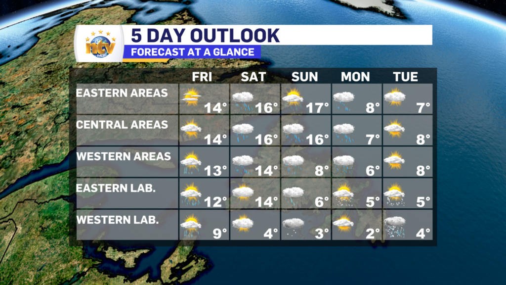
The day starts quiet and sunny over much of the Island, however, clouds will spill in throughout the day from southwest from west to east. Rain will arrive on the West Coast between 4 and 6 PM and will spread east overnight. Highs climb into the upper single digits to lower teens.
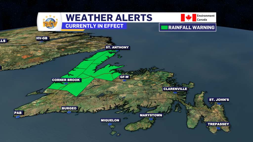
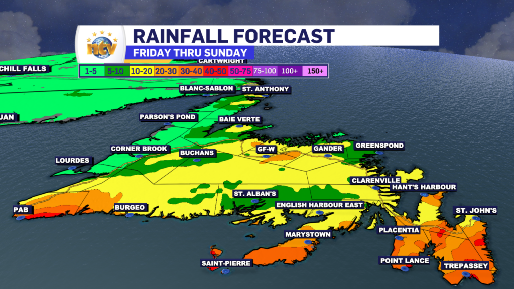
The rain will end from west to east late Wednesday night and Thursday morning and will be offshore by midday Thursday. Rainfall amounts will in the 5 to 15 mm range, with up to 30 mm for parts of the West Coast.
Thursday will then see clearing conditions across the Island, with highs reaching the lower teens.
Meanwhile, in Labrador, we will see showers in the west on Wednesday, with sunny skies in the east. Highs range from 7 to 10. A cooler day is on tap for Thursday, with some flurries and/or showers in the east. Skies will be cloudy to mostly cloudy and highs will be in the 2° to 6° range.

Friday will start quietly across the Province, but rain will spread into Central, western, and southern Newfoundland during the afternoon. Highs near 10°. Labrador will see sunshine Friday, with highs near 3°.
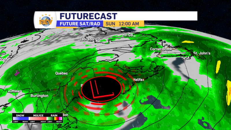
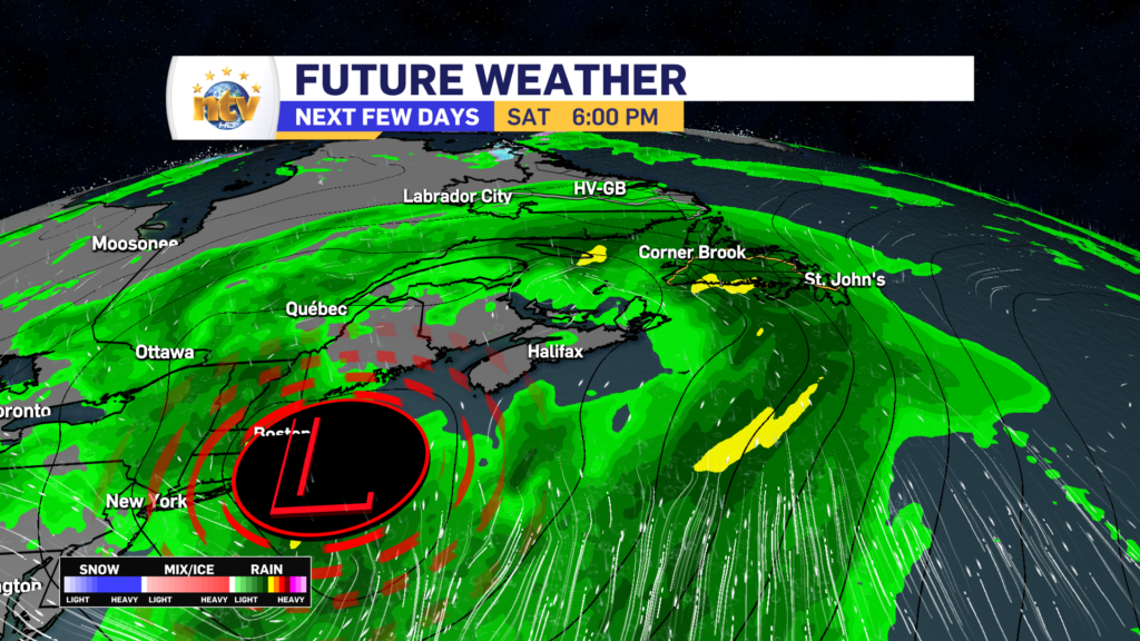
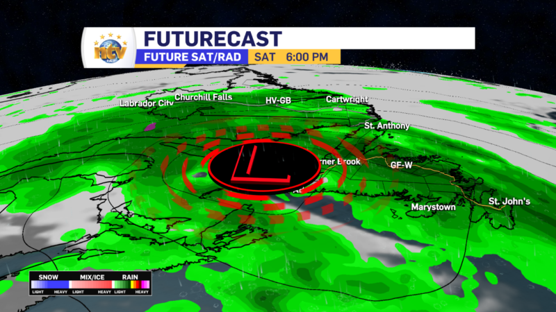
Saturday will be another rainy day on the Island, while rain and accumulating snow will fall in Labrador. At the moment, it’s still a little too early to get into snowfall amounts, however in some areas of the North Coast it does look like it will be a healthy amount. The first decent shot of the snow this season looks to be on the way.