More showers on Thursday, along with comfortable temperatures
The Overview
Our Thursday morning is starting off with some showers over, and just east of, the Avalon Peninsula. Radar shows this nicely and forecasts indicate that the activity will remain mostly offshore today. We are also seeing some showers over western and southwestern Newfoundland this morning, which will become more widespread in those areas as the morning and day moves along.
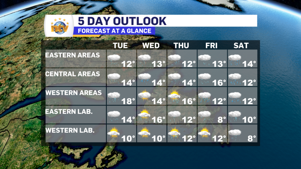
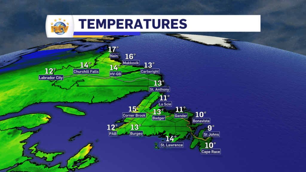
Thursday will see a narrow swath of partly cloudy skies from the Burin Peninsula to the northeast coast and as far west as Central. Eastern and western areas will be cloudy. Eastern areas, meaning the Avlaon, will see rainfall through some of the day, with showers lingering into the afternoon. Highs in the lower to middle teens. Meanwhile, expect isolated showers in Labrador, under mainly cloudy skies, with highs of 6 to 10. Fog will hug the coast again.

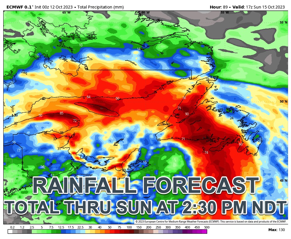
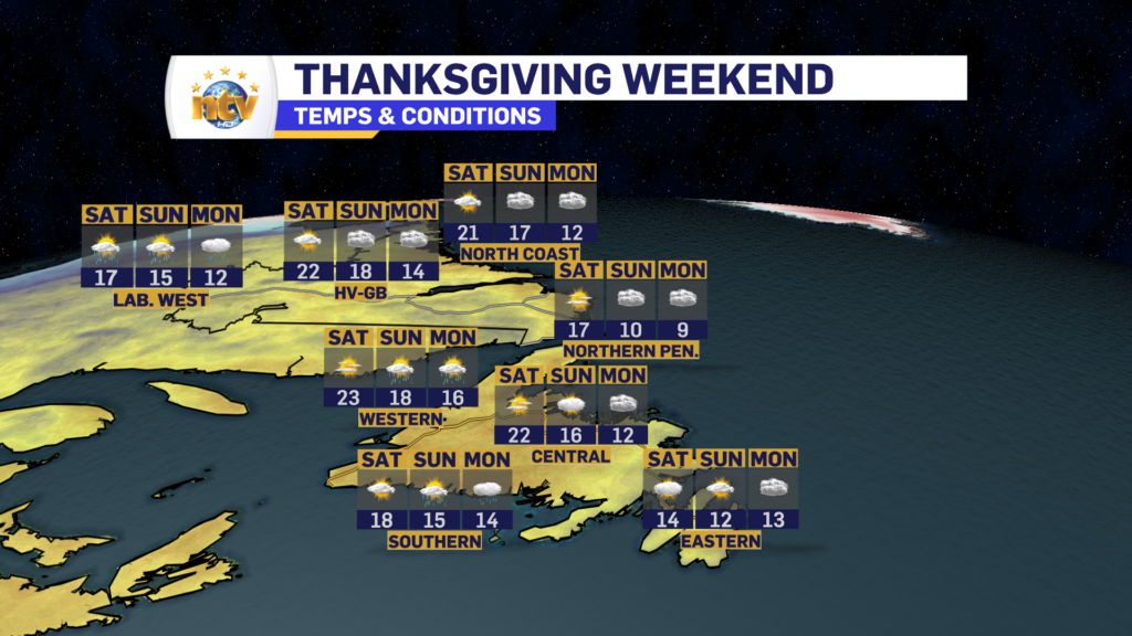
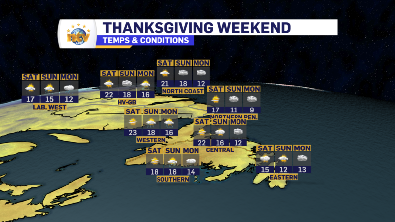
The next significant weather maker arrives Friday and will bring heavy rainfall to the Island from Friday night through Sunday. Some areas will see more than 50 mm of rain. I expect Special Weather Statements and Rainfall Warnings to be issued by ECCC ahead of this, at some point tomorrow or Friday. The rain lingers into Sunday before ending. Fall-like temperatures sweep across the Province for Monday as our weather pattern finally changes.