weather

Wednesday morning forecast; slow improvements today as the showers depart

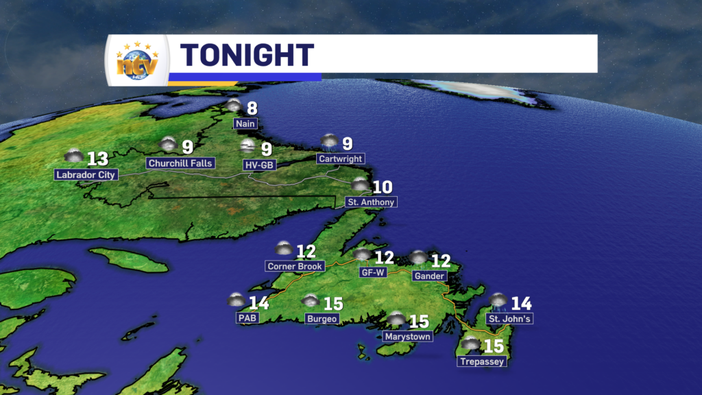
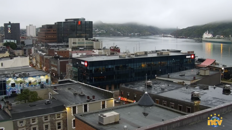
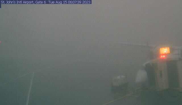
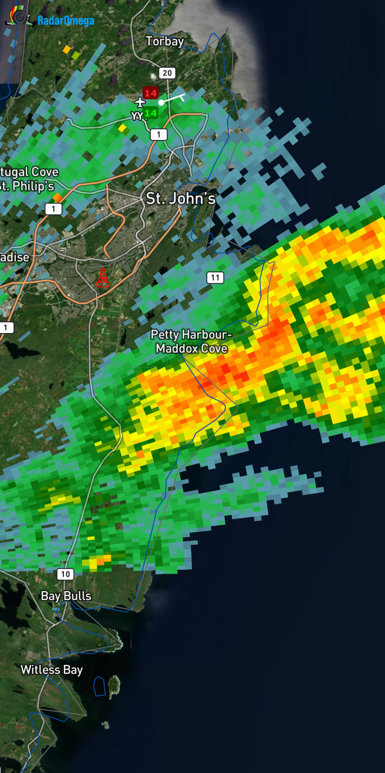
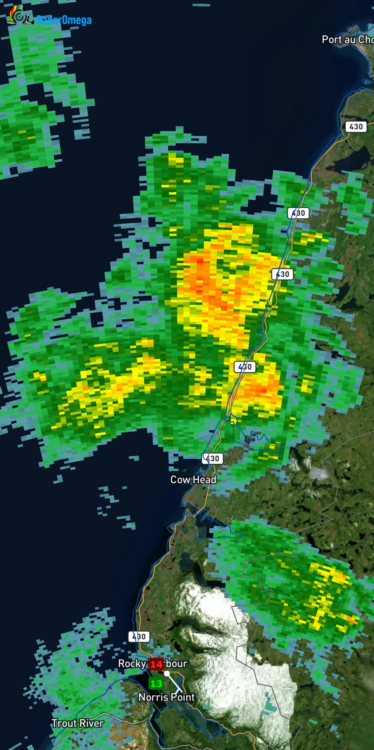
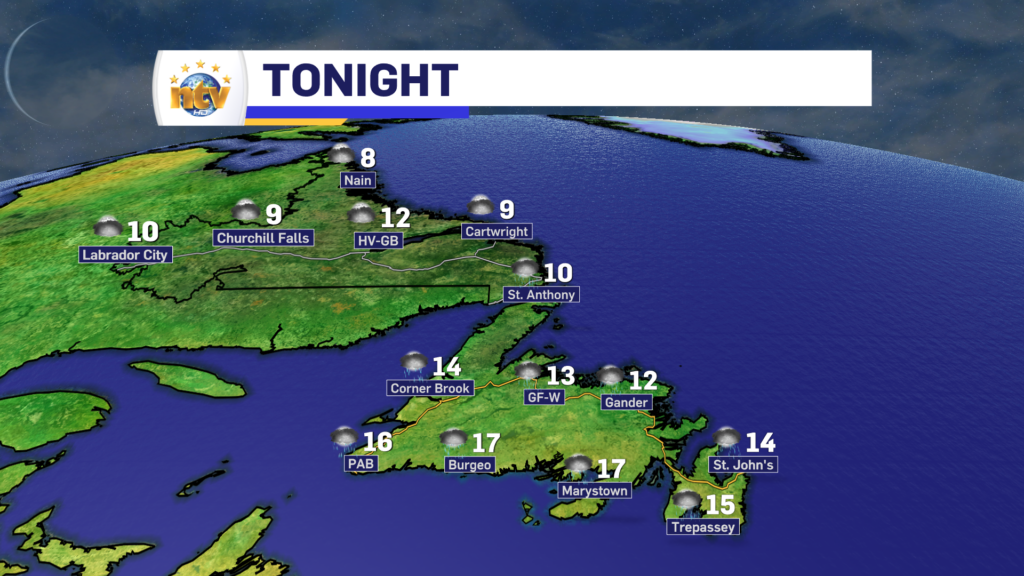
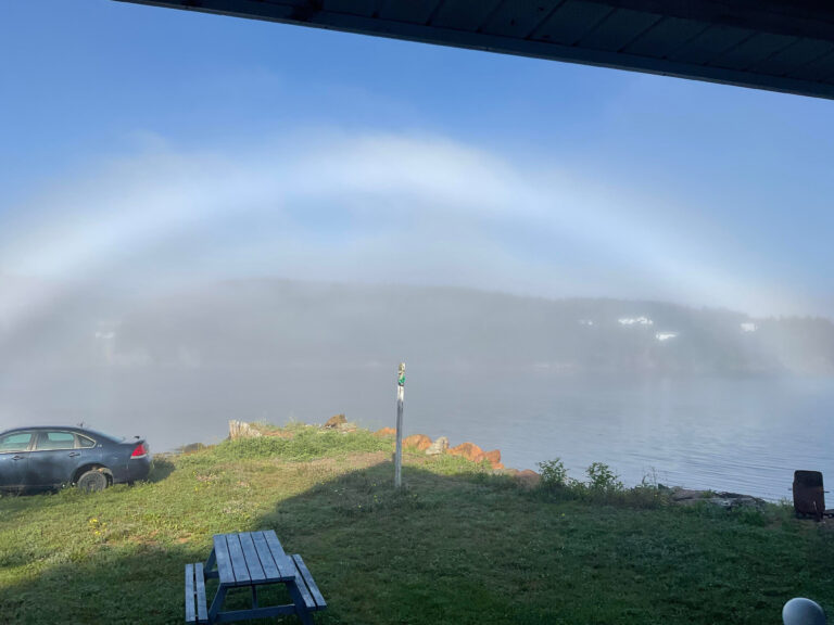
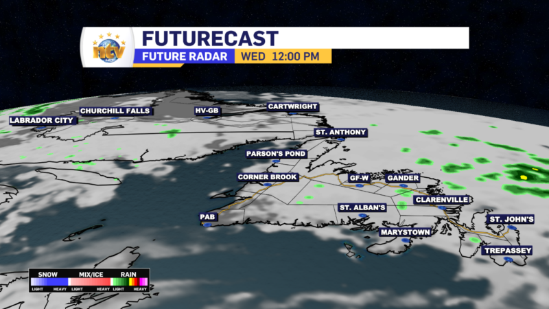
This morning we are waking up to more showers and clouds across a good chunk of the Island, specifically in central and eastern areas. There are even some foggy patches. Farther west we are looking at some breaks of clear sky.

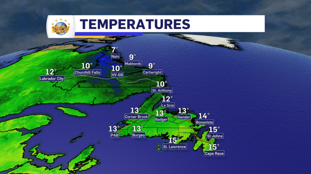
Temperatures are into the mid-teens and wind speeds are light on the Island. Labrador is seeing readings in the lower teens and even some single digits to begin the day.

Temperatures as of 6:30 AM NDT / 6 AM ADT

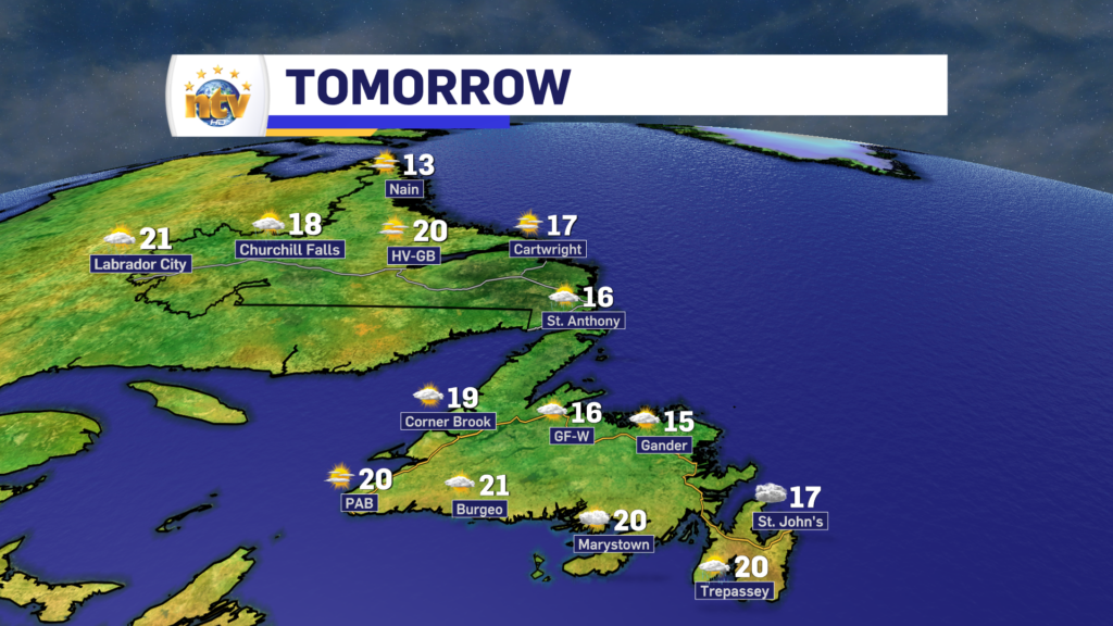
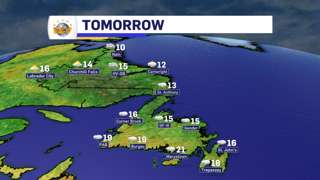
Today will see clouds decrease across the Island from west to east. In the west, the skies will turn sunny this morning, in Central that will be this afternoon, and in the east, it may not be until this evening.

Temperatures this afternoon will creep into the mid-teens to lower 20s for most areas of the Province. There will be some pop-up showers in Labrador West later today. Most of which should be minor.

Today’s forecast – August 16, 2023

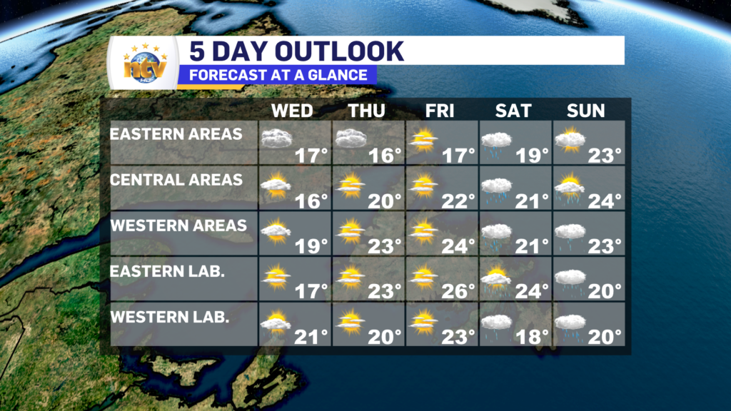
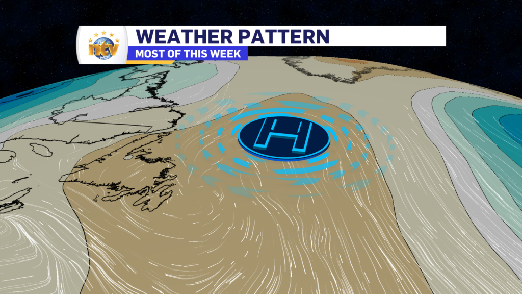
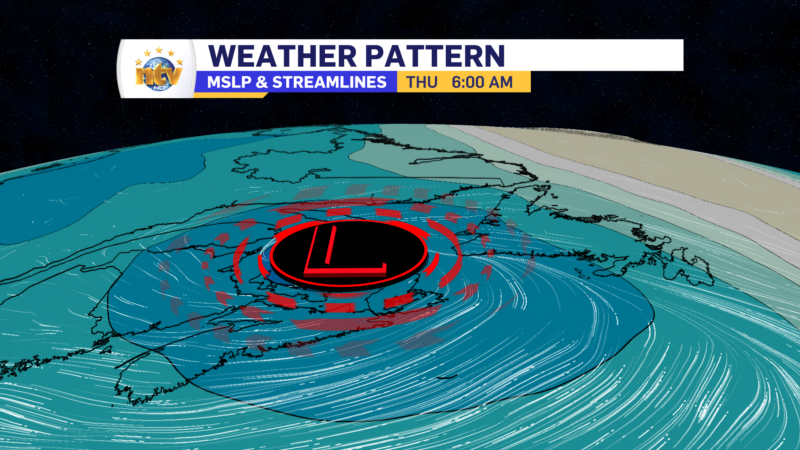
A peek at the extended

The rest of this week looks pretty good. Expect sunshine Thursday and Friday, with highs in the upper teens to lower 20s across the Province. The next chance of rain comes on Friday night and Saturday for Labrador West and the Island portion of the Province. I’ll further updates on this.

Have a great day!

Eddie

Eddie’s Tuesday evening forecast; rain showers tonight, less for Wednesday

Tonight’s Outlook

A weakening area of low pressure will swirl across the Island overnight. This will keep on-and-off showers on the go for areas of western, central, and eastern Newfoundland while the South Coast remains primarily dry. Lows in the lower to middle teens. Some coastal locations will see fog patches overnight. Wind speeds will be light.

Expect a few showers in Labrador in the southeast and the west overnight. Otherwise, it’s dry and partly to mostly cloudy. Lows near 10°.

Wednesday’s Outlook

A few showers will be found over eastern and central areas in the morning. The showers will end by early afternoon and skies will gradually turn partly to mostly cloudy. Areas of western Newfoundland, the GNP, and the South Coast will generally see sunshine. Highs range from the mid to upper teens east and central, to lower teens on the GNP, and near 20 for the West Coast and South Coast.

Labrador can expect mostly sunny skies, with highs in the teens to near 20. The cooler readings will be found on the north coast, while the mid to upper teens and near 20 will be found farther south and west.

Extended Outlook

Thursday looks quiet and sunny across the Province, with highs in the mid-teens in eastern Newfoundland to near 20, or higher, just about everywhere else in NL.

Friday will see be mostly sunny with highs in the upper teens to lower 20s.

Saturday will see periods of rain across much of the Province as an area of low-pressure swings through the region. Highs will be near 20°. Sunday will be a tad warmer, with highs in the lower to middle 20s. Showers may still be around.

Rain showers, drizzle, and fog will comprise Tuesday’s weather for the Island, while Labrador has a lovely day!

We are off to a bit of a foggy start this morning over parts of eastern and northeastern Newfoundland and cannot say that’s a surprise. The visibility at St. John’s airport this morning is being reported at 200 meters. This may have an impact on air travel from St. John’s Airport, so if you’re flying, be sure to check with your carrier.

St. John’s Int’l Airport webcam – 6:07 AM NDT on August 15, 2023

We are also seeing some rain showers across much of the Island to begin the day. The rain showers are numerous over both the eastern and western sections of the Island this morning. Some rain shower cells are quite heavy. The area between the Goulds, Petty Harbour, and Bay Bulls has been in and out of the heavy rain for the last hour or so. The showers are moving from west to east and should end up offshore in the next hour or less.

Areas of showers and/or light rain will continue to affect much of western, central, and eastern Newfoundland throughout the day. Fog will be an issue as well near east-facing shores thanks to onshore easterlies. The fog should get a little less dense for areas that see it, mainly the eastern parts of the Avalon, this evening as the wind turns from east to southeast. Skies remain cloudy today and highs peak in the mid to upper teens. Some spotty 20º readings may be found along the South Coast this afternoon.

And speaking of the South Coast, that’s the area that may see some sunny breaks on the Island today. And is probably the only area that will see that.

Max temperatures today, RDPS Model for August 15, 2023

Labrador will see a decent day, with highs in the teens to near 20. There will be some showers in the West later today, but overall the best weather today will be found in the Big Land.

The weather will improve… at least somewhat, for Wednesday. And I’ll have a more detailed update on that later today.

Have a good one!

Eddie

Eddie’s Evening Update; showers and rain return for Tuesday

A weak area of low pressure will swirl across the Island over the next 12 hours or so and will bring areas of rain, showers, and even the risk of some passing thunderstorms with it. The storm risk is overnight and anything that does develop should be rather isolated. This image from ECCC shows where the risk of minor storms is highest overnight.

Outside of the passing storms, showers will be widespread, along with areas of rain, tonight and Tuesday across much of the Province. It will also turn a bit cooler for most of us during the next 24 hours as winds turn onshore. Fog patches are possible too, mainly over eastern areas, through the time frame.

Lows tonight will be in the teens on the Island and teens to single digits in Labrador. Speaking of Labrador, expect quiet weather overnight and Tuesday. The only thing to look out for Tuesday will be some showers in the west during the afternoon.

The remainder of the week looks to remain on the cooler side across much of the Island as winds look to remain onshore. The reason for this will be a stubborn high setting up show north northeast of the Island. Chance for rain returns for southern and eastern sections of the Island on Thursday, and more widespread chances come in for Saturday.

Meanwhile, in Labrador, the weather looks to remain quiet for the next 4 or 5 days, with only scattered showers in the forecast. Temperatures rise to warmer-than-average levels by the middle and end of the work-week.

For your latest 7-day forecast and our live interactive radar, be sure to bookmark our weather page!

Rare Fogbow was spotted near Marystown over the weekend!

This is an excellent example of a fogbow! This photo was taken near Marystown over the weekend by Amy Walsh-Rowlands.

Amy was on her deck in Little Bay, Marystown (Burin Peninsula) having tea and this formed in front of her and her family. She says it was a foggy, misty morning so she assumed it was fog of some sort.

Amy says she has never seen fog form a fogbow.

What is a fogbow you ask?

A fogbow is a pale, almost colorless rainbow-like circle that appears in the foggy air. It’s kind of like a cousin to a regular rainbow. Just like a rainbow happens when sunlight passes through raindrops, a fogbow happens when sunlight passes through tiny water droplets in the fog.

But there’s a difference. While a rainbow has lots of colors, a fogbow is usually much fainter and mostly white or very pale. This is because the water droplets in fog are smaller than raindrops, so they don’t break the sunlight into separate colors as effectively.

So, think of a fogbow as a misty, ghostly circle of light that shows up in the fog when the sun is shining through it. It’s a pretty and rare sight, so if you’re lucky enough to see one, enjoy the magical moment!

Fogbow near Marystown on the weekend of August 12, 2023

How are fogbows and rainbows different?

Rainbows and fogbows are both colorful circles of light made by sunlight and water droplets. But they’re different because rainbows are made by bigger raindrops and have bright colors, while fogbows are made by smaller fog droplets and are paler. Rainbows are seen when it’s both sunny and rainy, while fogbows happen in foggy weather. Fogbows are like fainter, less colorful rainbows that can sometimes form full circles.

Eddie’s Update; Sunday’s forecast

Sunday will be a beautiful day across much of Newfoundland and Labrador. Expect partly cloudy to mostly sunny skies with highs into the upper teens to lower 20s. Humidex values will be in to the middle/upper 20s for some.

For your latest 7-day forecast and our live interactive radar, bookmark our weather page!

Eddie’s Saturday update: Weather improves through the day

Very few storms came through overnight… disappointedly for some. Like me.

The radar shows we had rounds of heavy rain work across the Island over the last 12+ hours. However, the thunderstorms I thought would be found in the rain never transpired. Or if they did, they were much less widespread than it looked like they would be just yesterday.

18-hour satellite radar loop – August 11 to 12, 2023

For the rest of today, the weather will generally improve on the Island, with sun and cloud becoming prevalent for most. The exception will be the West Coast and GNP, where showers and clouds will hang around through much of the day. Scattered showers will also be found this afternoon over central and eastern areas, with the chance of some isolated thunderstorms. Highs reach the upper teens to lower 20s.

Southeast Labrador will see rain become widespread today and that will ease off tonight. Otherwise expect partly to mostly cloudy skies across the Big Land, with highs in the mid to upper teens.

Saturday’s forecast – August 12, 2023

Sunday will be a decent day across the Province, with highs in the upper teens and lower 20s for most.

Forecast for Sunday, August 12, 2023

Have a great Saturday!

Friday will be decent for most of N.L., before rain arrives this evening

Good Friday morning! We’ve made it to the end of another work week and it looks like Mother Nature is going to reward many of us with a decent day.

Expect a large part of the Province to see a mix of sun and cloud today, with highs reaching the middle teens to lower 20s this afternoon. The coolest readings will be found in northern Labrador and the warmest over parts of Central and eastern Newfoundland. Below is a map of the expected highs today

Friday’s forecast | August 11. 2023

There will be some exceptions to the sunshine, and those areas will be found over the West Coast, Great Northern Peninsula, and parts of southeast Labrador, where showers will linger throughout much of the day. I also cannot rule out the chance of passing showers over Central and Eastern areas, especially this morning. In fact, radar shows a few over the Avalon and another near Fogo Island. Track them yourself using the interactive radar on the NTV Weather Page!

The next area of low pressure will swirl in tonight, and this will bring some heavy rain to parts of the Island late tonight and early Saturday morning. The weather on the Island will improve Saturday, while parts of Labrador will see the rain linger into Saturday. There is even the risk of some thunderstorms over parts of Central and eastern Newfoundland late tonight and Saturday morning. The map below shows this threat, and all you need to know about is the brighter the color the more likely storms are to pop up.

RDPS CAPE (Convective Available Potential Energy) Index – August 12 at 9:30 AM NDT

The rain from this next low will hold off until later this evening or later. I’ll have a more detailed update on the timing of it all later today.

Also, Saturday evening looks like it may be your best chance to see the Perseids Meteor Shower. Here is a blog post I put up yesterday about the event!

Have a great day!

Eddie

A soggy Thursday is on tap for much of the Province

A slow-moving, sloth-like, area of low pressure is really making its presence known across parts of the Province this morning. Virtually all of Newfoundland and parts of western Labrador are waking up to either rain, showers, or drizzle. It’s also a bit windy, which makes being outside in any of this more unpleasant than it has to be. The radar loop from the last 6 hours, ending just before 7 AM this morning, shows us where the rain is. The brighter the color, the heavier the rain.

The area of low pressure will trudge across the Island today and the rain, showers and drizzle will continue across the Island because of it. The rain will generally become less widespread and more showery as the afternoon and evening progress. Except on the Baie Verte and Northern Peninsulas, where some heavier rain will arrive this evening. Also, southern Labrador will see the rain and showers increase later today as well, as the area of low pressure begins to make its way off the Island.

Along with the rain, we can see temperatures will also be on the cooler side today, with highs across the board in the teens. Today will certainly have a fall-like feel to it, even though we’re in the early stages of August.

There are some signs of warmer weather on the horizon, but we will have to wait until the weekend to see that. Speaking of the weekend, the next area of low pressure will swirl in Friday evening, and this will bring more rain, and wind, to the Province. Ferry crossings between NS and NL may be impacted, yet again.

I’ll have your next update later today.

Have a good one!

Eddie

Rain moves in tonight and continues through Thursday on the Island while showers linger in Labrador

The Overview

An area of low pressure will meander through the Gulf of St. Lawernece over the next 24 hours, before finally crossing over the Island late Thursday into early Friday. The presence of this low is driving rain across much of the region this afternoon, and the rain will only increase in coverage overnight and Thursday.

The rain will become moderate to heavy at times over much of the Island tonight, and that will linger through the day on Thursday. There is a slight risk of some embedded thunderstorms, but I don’t anticipate them to be widespread at this time. The rain will taper to showers Thursday afternoon from south to north. The showers will not fully end until early Friday morning.

The showers will increase in southern Labrador late tonight and that will turn into heavier rain Thursday afternoon. The rain in southern areas of the BIig Land will linger into late Friday.

Rainfall amounts by early Friday morning will be in the 15-30 mm range for a large part of the Island, with lower amounts in Labrador. The rainfall projection below highlights that well.

Lows tonight will generally be in the lower to mid-teens on the Island and lower teens to near 10° in Labrador. Thursday will see temperatures similar to the last couple of days, with highs in the mid-teens to near 20 across N.L. There will not be a lot of sunshine during the next 24 hours.

Wind speeds in the Wreckhouse area will continue to be a problem through early Thursday. A Wreckhouse Wind Warning remains in effect until that point, and gusts will be from the southeast as high as 110 km/h.

The Extended

Friday will start on the calm side but will feature scattered showers across much of the Island and parts of Labrador. Skies will be partly to mostly cloudy across the Province. Highs will be mid-teens through the Big Land to lower 20s over much of the Island.

Another area of low pressure will roll through Friday night into Saturday. This looks to bring another bout of heavy rain to the West Coast, and parts of southern Labrador in that time frame. Areas north and east of the low, look to largely miss out on the heaviest rain. This next low may impact ferry crossings to Nova Scotia during that time frame.

Sunday will see a nice recovery across much of the region, with sun and cloud and highs back to the 20s for much of the Island and near 20 for parts of Labrador.

FOR YOUR LATEST WEATHER, BE SURE TO CHECK OUT THE WEATHER PAGE

Scroll to top